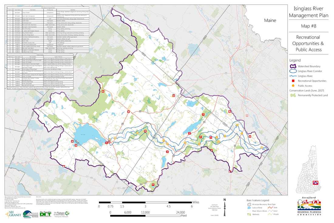
There are a variety of access points to the Isinglass River, some publicly owned and some private. Most publicly owned access points lack dedicated parking, but exist at most of the major bridge crossings (Routes 202A, 126, 202, and 125).
Click on each map below to download it to your computer and see our Isinglass River Scenes page for selected images from the river.
The section of river that runs near Routes 126 and 202 has gravel parking areas where the river can be accessed for fishing or paddling. A number of other public and privately held access points exist along the river as shown in the map below.
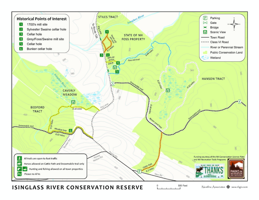
The Isinglass River Conservation Reserve near the Strafford - Barrington line provides trails and an opportunity to view the remnants of the Foss Mill, cellar holes and explore in all seasons of the year.
There is also a geo-caching site to find.
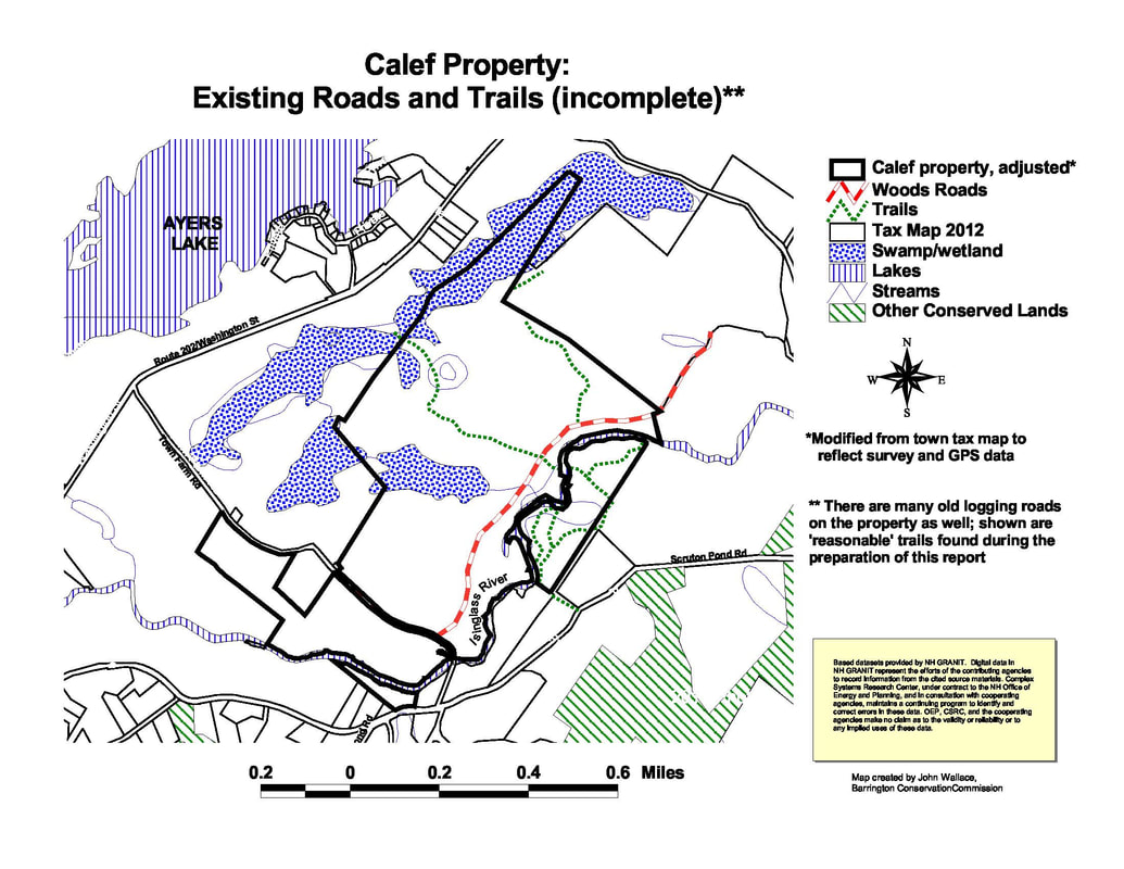
The Town of Barrington has two trails on the Isinglass river. Detailed write ups and trail descriptions are found on the Barrington Conservation Commission website. The A. Harlan Calef Isinglass Preserve has trails to and along the river starting from Town Farm Road off of Route 202. These trails and parking are still under development at this time.
|
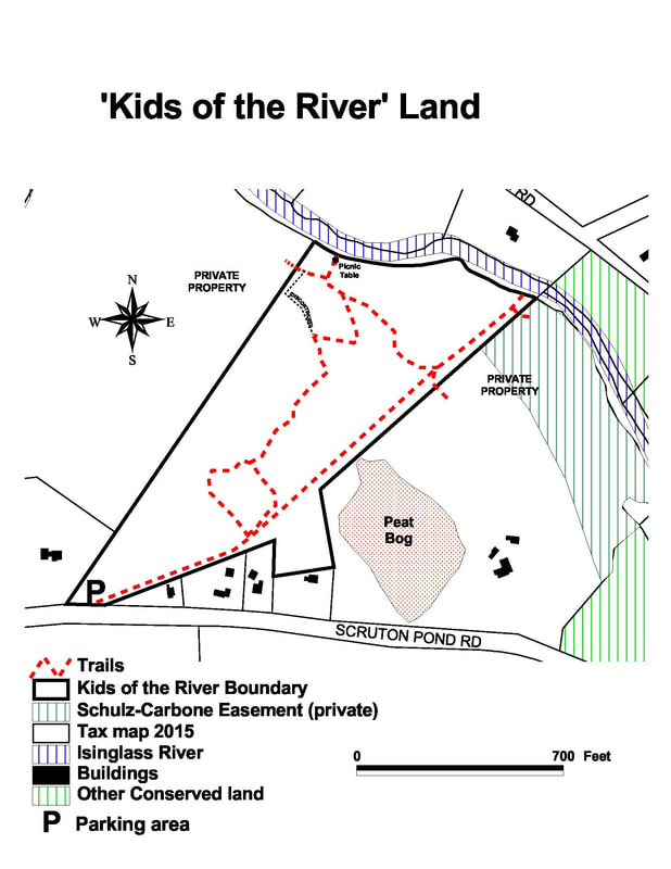
The Kids of the River trails start on Scruton Pond Road, about 1.5 miles off of Route 125, and lead to a picnic area along the river.
|
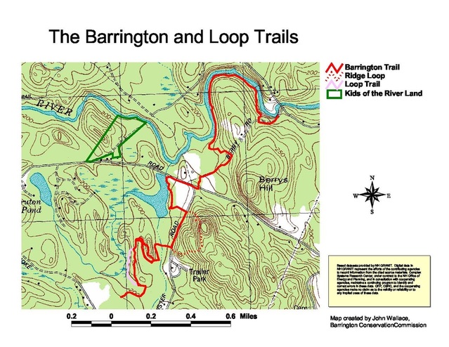
The Barrington Trail starts off of Green Hill Road about 1 mile from Route 125.
The trail follows the river, then veers away and crosses Scruton Pond Road east of the
Kids of the River Trails.
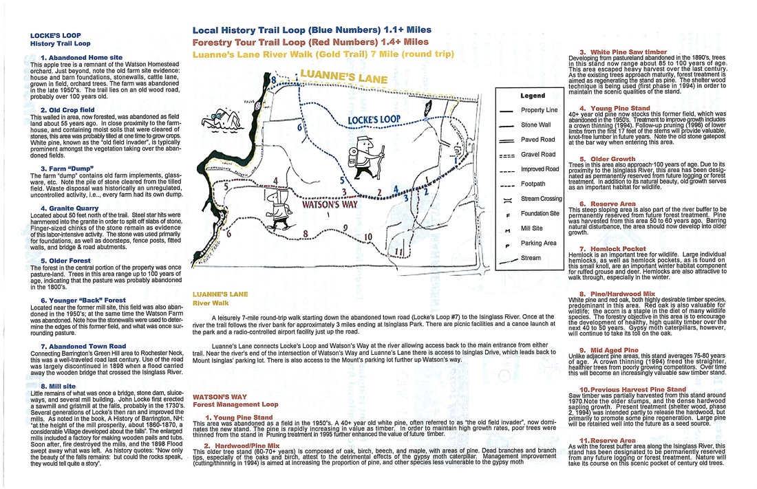
The multi-purpose Gonic Trails area owned by Waste Management, Inc. is located off of Route 125 along Rochester Neck Road. Open year-round, the recreational park is used for hiking, biking, fishing, swimming, and picnicking in the summer and ice skating, cross-country skiing, and snowshoeing in the winter. Three trails lead from the parking lot and include: Watson’s Way, a 1.4 mile loop, Locke’s Local Loop, a 1.3 mile loop and Luanne’s Lane, a 3.5 mile one way trail provides opportunities for hiking, swimming, and picnicking around Locke Falls. Visit their Facebook page!
The multi-purpose Gonic Trails area owned by Waste Management, Inc. is located off of Route 125 along Rochester Neck Road. Open year-round, the recreational park is used for hiking, biking, fishing, swimming, and picnicking in the summer and ice skating, cross-country skiing, and snowshoeing in the winter. Three trails lead from the parking lot and include: Watson’s Way, a 1.4 mile loop, Locke’s Local Loop, a 1.3 mile loop and Luanne’s Lane, a 3.5 mile one way trail provides opportunities for hiking, swimming, and picnicking around Locke Falls. Visit their Facebook page!
